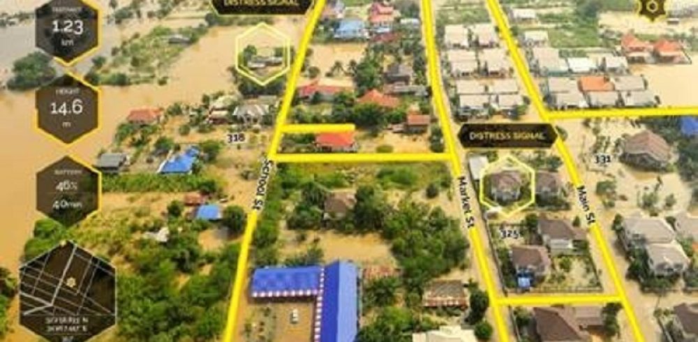
Another advancement in drone technology has been made, as an augmented reality technology company based in Israel has been supplying the equipment and the augmented reality software for drones for the first responders working on the frontline of the Hurricane Harvey efforts last week.
Drones have been used by first responders in emergency situations to speed up the search for survivors. However, these relief efforts have been hindered in the past by poor visibility from the drone and a lack of mapping technology in order to gain a precise location. Edgybees, the augmented reality company based in Israel has developed software that is powered by advanced algorithms and uses the information that has been gathered through real-world sensors and a range of other devices like cameras, GPS and inertial measurement unit and altitude meters in order to precisely reconstruct the movements of the device. This mapping also takes place in 3D to offer extra precision.
The drone is also operated with a range of cloud-based sources that, with the engine created by Edgybees provides lighting that will correspond to the scene captured by the drone with representations of potential obstacles and objects. The application engine used by the drone is time-synced, with means that the engine can be put over the actual video being transmitted live from the drone and allows an increase in the speed of development for real-time applications.
Edgybees developed their augmented reality technology initially to be used for games, it is brilliant that such technology can be adapted and used by the first responders following Hurricane Harvey. The AR overlays offer the drone pilots information such as street names, house numbers and the locations of distress signals which allows those working as first responders to take the best route through the debris to rescue survivors. It is thought that this technology will also be used by the first responders working to assist the search and rescue efforts following Hurricane Irma.


